dailynewsnblog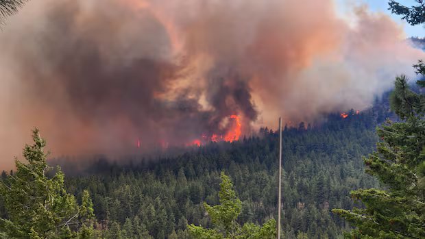

Listen to this article
Estimated 4 minutes
The audio version of this article is generated by AI-based technology. Mispronunciations can occur. We are working with our partners to continually review and improve the results.
The Latest:
- Regional officials said they have heard frustration from families who evacuated their homes in Summerland, B.C., but said they “can’t even think about” lifting evacuation orders until the Bald Range fire is better controlled.
- Temporary access permits to Summerland are being triaged, with utility crews getting priority to ensure utilities can adequately sustain the community.
- The B.C. Wildfire Service (BCWS) reminds people to stay clear of the Bonanza Creek wildfire, as it’s a popular recreational area surrounded by numerous provincial parks.
- The province issued yellow and orange air quality warnings for regions across the central and southern Interior.
- The Ainslie Creek wildfire, one of two fires in the Brunswick Complex, saw growth towards Highway 8. The highway currently remains open as crews maintain 24-hour operations.
- The BCWS says “new ignitions occurring during periods of hot and dry weather can establish and spread quickly.”
Bald Range wildfire still burning out of control
During a Tuesday livestream from the Regional District of Okanagan Similkameen, Summerland Mayor Doug Holmes said they cannot consider lifting evacuation orders or alerts until the Bald Range wildfire is under control.
A BCWS update on Tuesday said overnight recoveries were poor due to clear skies and fuels remain “exceptionally dry and highly receptive to fire.”
Officials say the volatile nature of the wildfire challenges their ability to plan ahead, as they are still responding to the fire as it progresses.

“We have to make sure it’s safe,” said Holmes.
Until then, temporary access permits are being granted in some circumstances.
Permits are “basically triaged,” according to Deborah Jones-Middleton, the protective services manager with the district. She said utilities professionals, for example, will be permitted into the area as long, as it’s safe to do so, to ensure utilities are adequately running to sustain a community.
There were 100 firefighters from Mexico battling the Bald Range fire on Tuesday, bringing the total number of ground personnel to 193. Heavy equipment, aviation personnel continue to construct control lines, while structure protection is in place around the community.
Brunswick Complex nears another highway
As of Tuesday afternoon, the Ainslie Creek wildfire had scorched roughly 614 square kilometres of land, and its northeastern edge was only about three kilometres west of Highway 8, which runs through Merritt.
The northeast edge of the wildfire is roughly 20 kilometres northwest of Merritt. The BCWS noted the Ainslie Creek fire hasn’t crossed control lines or entered the community.
As a result of the growing fire, the Lower Nicola Indian Band expanded its evacuation alert to cover all properties in the Nicola Mameet Indian Reserve No. 1. It also issued an evacuation order for a property on its Speous Indian Reserve No. 8.
The BCWS said in its Tuesday update that the fire remains active along the northeast and southeast flanks, growing eastward throughout Monday. It added that as of Tuesday morning, the fire stopped about two kilometres short of control lines, and had not impacted Highway 8.
The Ainslie Creek wildfire has a pattern of showing aggressive behaviour and major growth, according to the service, when any two factors of elevated winds, low humidity and clear skies combine.

The Brunswick Complex consists of the Brunswick Creek wildfire, burning on the east bank of the Fraser River above Boston Bar, and the Ainslie Creek wildfire, burning on its west bank. Highway 1 is directly affected by the wildfires and remains closed.
There were 236 firefighters, 20 helicopters, 59 pieces of heavy equipment and 85 structure protection personnel fighting the Brunswick Complex as of Tuesday.
Road closures
According to DriveBC, most of the major highway closures from previous days remain the same.
Due to the Bald Range wildfire, Highway 97 is closed between Peachland and the Pyramid Picnic Area in Kickininee Provincial Park. Traffic is being redirected to Highway 33.
Westside Road also remains closed due to the Bradley Creek Complex, burning on the west bank of Okanagan Lake, north of Penticton.
Other closures to Highway 1 north of Hope and Highway 97 north of Cache Creek remain in place.