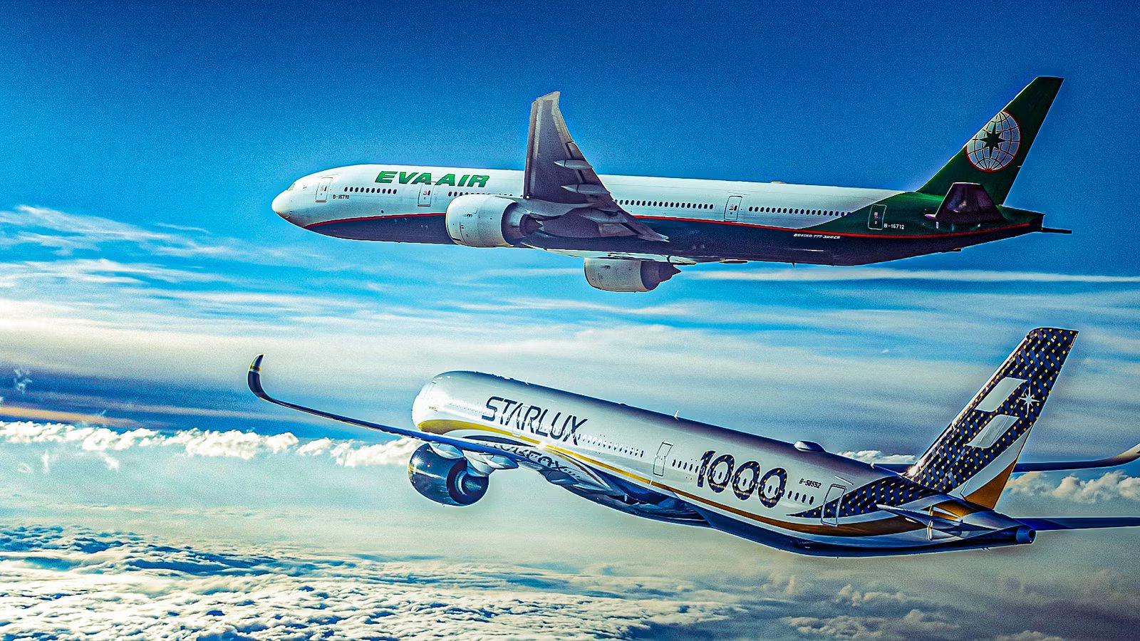
For years, passengers flying across the vast expanse of the Pacific Ocean have snapped pictures of other jetliners flying in what appears to be proximity. These remarkably close flight paths are not near misses as some fear, but rather the result of a complex route-optimization system that directs much of the air traffic through the same channels. The Pacific Organized Track System places long-haul jetliners on one of the many invisible highways in the sky that maximizes fuel efficiency by leveraging jet stream conditions and avoiding severe weather over the ocean.
Even though these aircraft sometimes come close enough for passengers to photograph other planes in the air, the narrow corridors are still large enough for the planes to remain at least 1,000 feet apart. Tracks are typically spaced 50 nautical miles (93 km) apart horizontally, but planes on parallel routes using vertical separation can come much closer.
Unlike flights over land, where planes follow fixed airways, oceanic routes are flexible and recalculated daily based on shifting weather patterns. The most frequent point in transit where this phenomenon occurs is at the gateways, where, despite the vast expanse of the Pacific, these different tracks converge in the sky.

A long list of operational and weather considerations goes into the routing of every single airliner that crosses the ocean, but ultimately the jet stream is the most influential factor. Because the most efficient core of a jet stream is relatively small, multiple aircraft from different origins, like Tokyo, Hong Kong, or Seoul, are often funneled into the same narrow track heading toward the West Coast of the United States.
Another important reason is safety. Because the Pacific lacks ground-based radar and easy emergency landing sites, air traffic controllers use PACOTS to organize traffic. Severe weather or volcanic ash clouds can further compress available airspace, forcing aircraft into even tighter corridors to avoid turbulence or hazardous conditions.
The jet stream boost experienced by airplanes when they fly through the core can provide a speed increase of up to 200 mph (322 km/h). That can cut flight time on a trip from Tokyo to Los Angeles by hours and save thousands of gallons of fuel. The difference between these benefits can be as small as a 50-mile change in course. For that reason, many airplanes can be stacked in close vertical separation and time spacing to maximize the benefit for as many planes as possible.
To prevent tailgating on the same track, controllers assign specific Mach speeds to each aircraft to maintain a constant time gap of 10 minutes between them. When two planes fly at similar speeds in the same direction, they can appear to be almost stationary next to each other. This visual effect allows passengers to easily focus their cameras and take clear, detailed photos of the other aircraft from the windows.
Great Circle Routing: Highways In The Sky

Since the Earth is a sphere, the shortest distance between two points is still a straight line, but on a map, it looks like a curve. This is called great circle routing and provides the most direct flight path between two distant points on the globe. While a flat map makes it look like a flight from Tokyo and a flight from Seoul should be hundreds of miles apart, the curvature of the Earth pulls these paths toward a single, shared arc.
The Earth is widest at the equator and tapers toward the poles. A Great Circle is the shortest path between two points on a sphere, which naturally arcs toward these higher latitudes where the Earth’s circumference is smaller. For almost any city in East Asia heading to North America, the Great Circle route arcs north toward the Aleutian Islands or Alaska. This creates a bottleneck.
Once aircraft hit the optimal navigation arc, they are essentially locked onto a single rail in the sky and end up flying nearly the same line across the North Pacific. To maintain safety, air traffic control uses PACOTS to stack these converging planes vertically or on parallel tracks. If it were not for these flight routes, travel time across the Pacific would be much longer, and fuel burned would greatly increase.
What Plane Has The Highest ETOPS Rating?
The A350 has the highest ETOPS rating of 370, meaning it can fly up to six hours and 10 minutes from the nearest usable landing strip.
The ETOPS Gateways: Safety First For Flyers

Extended-range Twin-engine Operational Performance Standards is a global safety standard for all long-haul flights that cross oceans and continents over vast areas of uninhabited land. Regulations require twin-engine aircraft to remain within a specific time window of an emergency airport, typically 180 to 240 minutes, in case one engine fails. To remain legal, airlines must tie their routes to specific diversion hubs such as Adak, Wake Island, or Midway.
ETOPS Gateways are specific geographic waypoints that act as checkpoints between land-based radar control and oceanic procedural control. Every aircraft must cross these waypoints to enter or leave the oceanic track system. Large sections of the Central Pacific have no suitable landing strips. On top of that, large areas of the Pacific are a kind of black hole for air traffic because there are gaps in the traditional ground-based radar, which is limited to a 200 to 250-mile range from shore.
These safety requirements force flights from Manila and Tokyo to hug the same safety corridors, putting them in the same narrow airspace for hours. Without radar, controllers traditionally used procedural separation, keeping planes hundreds of miles apart to account for potential position errors. Today, however, modern systems like Space-Based ADS-B and ADS-C now allow aircraft to broadcast their precise GPS location via satellite.
Why Pilots Sometimes Avoid The Shortest Route On Purpose
Looking at a flight tracker often shows a wide range of interestingly shaped routes. They may look strange, but there is a method to the madness.
Opening Up Free Air Travel Over the Ocean

The track system is designed to provide a level playing field for all airlines, regardless of whether they are a major carrier or a smaller operator. PACOTS uses moving corridors to keep aircraft moving across the vast expanse of the Pacific, using the best technology to find the optimal routes twice a day. Air traffic management centers in Japan and the US recalculate the oceanic corridors twice daily.
The PACOTS tracks are published via Track Definition Messages, allowing every airline access to the same prime real estate in the sky. Every airline wants the fastest route to save money on fuel, since it is the single highest operating cost, so the system funnels flights into groups. This results in convoys of planes from different companies trailing each other within minutes of each other. When demand for a specific track exceeds its capacity, air traffic control uses prioritization rules based on arrival times and requested altitudes to prevent any single carrier from monopolizing the most fuel-efficient altitudes.
Because the jet stream moves, meanders, and changes speed daily, a fixed airway would be efficient one day and a massive headwind the next. The tracks are literally laid down during the strongest winds for eastbound flights to give everyone a free ride. The invisible highways are rebuilt every 12 to 24 hours to account for three shifting variables. On days with extreme traffic, such as holiday surges, PACOTS may create additional parallel tracks to handle the volume, even if some of those tracks are slightly less efficient.
The jet stream is the primary engine of the PACOTS design. The jet stream can shift hundreds of miles north or south in a single day. If the track didn’t move with it, airlines would burn significantly more fuel. Eastbound tracks are numbered and follow the tailwinds; westbound tracks are lettered and are often designed to skirt around the edges of the jet stream to avoid its powerful headwinds.
What Is The World’s Longest Over Water Route With No Alternative Landing?
The route involves crossing a large portion of the Pacific Ocean.
UPRS: A Personalized Way To Fly

PACOTS was established in the 1980s to address the rapid growth of air traffic between Japan, Southeast Asia, and North America. The system was developed as a collaborative effort between the FAA’s Oakland Center and the Japanese Air Traffic Management Center ATMC. It was designed to provide a flexible, daily adjustable routing system for trans-Pacific traffic, complementing existing North Pacific routes, or NOPAC.
The User Preferred Route is a newer concept that moves away from shared tracks, allowing airlines to plan a unique, custom flight path for each aircraft. UPRs offer a customized profile for each and every airplane flying across the Pacific. A Boeing 787 can choose a slightly different flight path than an Airbus A350, depending on its specific weight, fuel burn rate, and departure time.
Trials have shown that UPR can save up to thousands of pounds in fuel on a single long-haul flight, such as Singapore to Melbourne or Hong Kong to Sydney. Because UPR is so much more efficient, authorities such as the Civil Aviation Authority of Singapore and Air Services Australia have begun permanently removing traditional flex tracks in certain regions to make way for UPR.
UPRs have largely been made possible by Space-Based ADS-B navigation. Satellite-based technology effectively provides radar-like coverage across 70% of Earth’s surface that ground-based radar cannot reach. Traditional oceanic travel relied on estimated position reports sent every 10 to 14 minutes, requiring massive safety buffers of 80 to 100 nautical miles between planes. Space-based surveillance has completely changed this.
Using a constellation of 66 satellites, aircraft now broadcast their precise GPS positions, altitudes, and speeds to controllers every 1 to 2 seconds. Because controllers see exactly where every plane is at all times, they can safely reduce separation standards. In some high-traffic oceanic regions, lateral and longitudinal spacing has been cut from roughly 40 miles down to just 5 nautical miles (28 km). This creates even more fun photo-ops for flyers along the way.