dailynewsnblog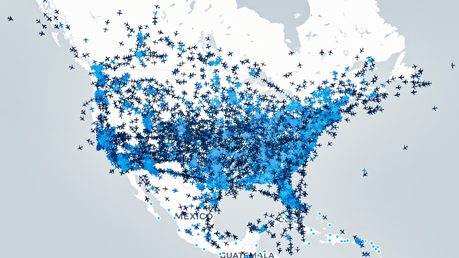
Many airliners, when cruising, appear on a smartphone flight tracker screen as a smooth, continuous icon moving across a digital map. Most passengers assume this seamless display is driven by air traffic radar sweeping the skies or a direct satellite link constantly beaming video down to Earth. In reality, ground-based primary radar cannot reach aircraft across vast oceanic gaps, and older tracking systems were never designed for real-time consumer streaming.
When monitoring live flights through the Simple Flying Flight Tracker, users have access to a global, decentralized network that translates unencrypted radio pulses into pinpoint digital coordinates. It’s natural to ask how this is possible, and how the tracker knows where all these flights are at any given moment.
Primary And Secondary Radar

Traditional air traffic surveillance once relied almost entirely on primary radar, which works by bouncing high-powered radio waves off an aircraft fuselage to measure distance and bearing. Primary radar gave air traffic controllers a reliable tool for decades, but it suffered from a major limitation. It could only identify where an airframe was located, not what aircraft it was, how fast it was climbing, or where it was heading. The lack of these data points led aviation authorities to develop secondary surveillance systems that rely on aircraft actively answering ground queries.
Secondary surveillance radar introduced the transponder, an onboard transmitter that responds to ground interrogations by beaming back an altitude reading and a four-digit squawk code. Modern commercial airliners operate Mode Select, or Mode S, transponders that can transmit rich data packages on a dedicated frequency of 1,090 MHz. When a controller assigns an emergency squawk code like 7700 for a general onboard emergency or 7600 for a loss of radio communication, the Mode S unit immediately broadcasts this status to every receiver within 200 nautical miles (370 km).
Even advanced Mode S radar interrogations still need a ground station to actively ping the aircraft before it responds, leaving vast stretches of airspace unmonitored. This dependence on ground-initiated queries made many wonder: what if the aircraft could determine its own position and broadcast it continuously without waiting to be asked?
Where The Data Comes In

Automatic Dependent Surveillance-Broadcast, or ADS-B, flips the traditional radar model on its head by shifting the positioning burden directly to the airframe. The system is automatic because it requires no pilot input or ground interrogation to operate, and dependent because it relies on high-precision data from onboard Global Positioning System (GPS) receivers. Instead of waiting for a radar ping, an ADS-B Out unit continuously broadcasts the precise latitude, longitude, pressure altitude, and horizontal velocity of the jet.
The digital broadcast occurs roughly once every second, sending unencrypted radio bursts across the 1,090 MHz frequency band to any listening receiver within line of sight. A single commercial aircraft cruising at high altitude can project its signal across a radius of over 250 nautical miles (463 km), as noted by Pager Power. This lets ground stations ingest hundreds of precise positional updates every minute, and by harvesting these high-frequency bursts from thousands of volunteer and commercial ground receivers worldwide, live tracking networks build a millisecond-accurate picture of global airspace.
However, because line-of-sight radio signals travel in straight lines and cannot bend around the curvature of the Earth, low-flying aircraft or airframes operating in remote valleys frequently drop below the horizon of ground receivers. This boundary creates an immediate engineering challenge for developers building a flight tracker. So how do tracking networks maintain smooth, continuous flight paths when terrain or distance blocks the signal?
Predicting The Next Move

If an aircraft slips behind a mountain range or descends below receiver coverage, tracking platforms will make use of dead reckoning algorithms to predict the flight path until the next radio packet arrives. Using the last known GPS position, ground speed, true heading, and rate of descent, the software projects the airframe’s logical trajectory along its filed flight plan. The moment a ground station regains line-of-sight contact, the algorithm reconciles the estimated position with the true broadcast coordinates.
Minimizing coverage gaps on the ground is a constant challenge; therefore, networks rely on thousands of ADS-B receivers installed near major hubs like LHR and remote regional outposts alike. A receiver unit costs less than $200 to build using basic software-defined radio hardware, as per The SWLing Post, making it possible for thousands of independent stations to feed real-time telemetry into central servers. When multiple ground stations pick up the same broadcast simultaneously, central processing nodes use timestamp comparison to verify data accuracy and filter out corrupted signal bursts.
Catch what other trackers miss
Emergency squawks, holds, NOTAMs — live signals, no signup.
Open tracker
Catch what other trackers miss
Emergency squawks, holds, NOTAMs — live signals, no signup.
Open tracker
While thousands of ground receivers provide complete coverage across populated continents, they hit an absolute limit at the ocean edge, detailed in Simple Flying coverage. In fact, this constraint is easily the largest vulnerability of terrestrial tracking, because platforms cannot easily monitor flights crossing 6,000 miles (9,656 km) of open water where no ground receivers can exist.
Space-Based Solutions

Beyond terrestrial antennas, ADS-B receivers are now deployed directly into low Earth orbit. According to Air Traffic Management reporting, space-based ADS-B uses satellite constellations orbiting hundreds of miles above the planet to listen for the same 1,090 MHz radio bursts emitted by commercial airliners. Satellites look down on the atmosphere from above, so terrain obstructions and ocean expanses no longer block signal reception.
Companies like Aireon have hosted ADS-B receiver payloads on the Iridium NEXT satellite constellation, creating a global orbital network capable of tracking aircraft anywhere on Earth. Whenever an airliner crosses the North Atlantic or the vast expanse of the Pacific Ocean, its onboard transponder continues broadcasting once per second, with the signal traveling upward to an orbiting satellite before being relayed back to ground control centers in milliseconds. It has helped usher in an era that does not rely on historical oceanic procedural separation rules that previously forced widebodies to maintain vast buffers over water.
Shifting from ground-based receivers to space-based satellite constellations solves the oceanic visibility problem, but the next challenge becomes data management, latency, and system redundancy. Moving from local radio reception to a global orbital network changes not just how aircraft are tracked, but how the entire aviation industry handles emergency response and traffic management.
When The Data Can Be Turned Against Itself

Real-time satellite tracking completely reshapes how air traffic controllers, airlines, and flight tracking platforms respond to airborne emergencies. In the past, an aircraft encountering mechanical trouble over the ocean might descend out of radar coverage, leaving investigators with an agonizing search area spanning thousands of square miles. With continuous space-based ADS-B monitoring, search and rescue authorities receive precise, up-to-date telemetry right up to the final moment of contact.
A clear illustration of this safety revolution occurs when a flight crew selects squawk code 7700 on their Mode S transponder over open ocean. The emergency status code is picked up instantaneously by an orbiting satellite payload, and relays it to flight tracking systems within seconds, triggering immediate alerts across air traffic management networks long before the aircraft reaches land. These emergencies can also be filtered using the flight tracker, making it easy to see exactly where the emergencies are taking place.
Now that space-based ADS-B coverage is becoming universal across all airspaces, aircraft can be tracked more easily and accurately than ever. At the same time, technology that can harm this kind of tracking is also becoming more sophisticated. As reported by Simple Flying, GPS jamming and spoofing are becoming incredibly prevalent, so how avionics manufacturers and regulatory bodies will secure these broadcasts against signal spoofing and cyber vulnerabilities will be crucial going forward. Simple Flying’s tracker stays well ahead of these instances, offering alerts and clear breakdowns of when aircraft data may be erratic or unusual.
A Truly Underrated Advancement

The evolution of flight surveillance from primitive primary radar to space-based ADS-B is easily one of the most underappreciated and overlooked developments in modern aviation history. What began as a tool to keep aircraft from colliding near congested airports has expanded into an open, global information network accessible to anyone with a smartphone.
Regulatory agencies like the Federal Aviation Administration and Eurocontrol are now enforcing universal ADS-B mandates, and unequipped commercial airframes have become virtually non-existent in controlled airspace. Artificial intelligence has also made its way into this realm of technology, and predictive modeling will soon allow flight trackers to anticipate turbulence, optimize flight routing, and streamline airport arrivals long before an aircraft enters the pattern.
For millions of aviation enthusiasts, passengers, and industry professionals monitoring live traffic, the continuous dot moving across the screen is actually all thanks to the seamless convergence of orbital satellites, ground stations, and advanced onboard avionics. This combination ensures no commercial flight ever truly flies out of sight.