dailynewsnblog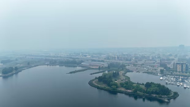
A total of 190 active fires were burning across northern Ontario on Saturday morning, with seven new fires being confirmed in the northwestern region Friday night, provincial authorities said.
Those seven new fires bring the regional tally to 131, according to the provincial Aviation, Forest Fire and Emergency Services (AFFES) agency.
AFFES says that overcast conditions on Friday following overnight rainfall helped limit fire growth and behaviour across all active fires.
The latest wildfires in the northwestern region, covering an area of roughly 252 hectares, are:
- Nipigon 67 (NIP067) was confirmed Thursday evening, approximately seven kilometres west of Crib Extension Road, southeast of Cavell Lake. The five-hectare fire is not under control.
- Nipigon 68 (NIP068) was confirmed Thursday evening north of Percy Lake. The 0.7-hectare fire is not under control.
- Kenora 19 (KEN019) was on an island in Black Sturgeon Lakes, east of Peterson Road. The fire was called out at 0.1 hectares.
- Fort Frances 40 (FOR040) was located near Rocky Island Road and Hopkins Bay Islet Road. The fire was called out at 0.1 hectares.
- Fort Frances 41 (FOR041) is north of Secret Lake, near Sedgwick Lake Road. The 0.1-hectare fire is under control.
- Sioux Lookout 98 (SLK098) is near the north end of Michikenis Lake. The 110-hectare fire is being observed.
- Sioux Lookout 99 (SLK099) is approximately 4.5 kilometres north of Wharram Lake. The 136.6-hectare fire is being observed.

Fire crews are working to tamp down on destructive wildfires that have destroyed communities and forced thousands to flee in southwestern Ontario. Here’s a recap of how the first few days unfolded.
An additional two new fires in northeastern Ontario were also confirmed by AFFES on Friday:
- North Bay 34 measures 0.1 hectares and is on a small island on the northern bay of Sand Lake, approximately nine kilometres northeast of Restoule Provincial Park. This fire is being observed to allow for the natural benefits of fire on the landscape, as it is safely away from communities and infrastructure.
- Sudbury 28 is 0.1 hectares and is near Eatlots Lake, which is a small lake west of Lake Wanapitei. One fire crew is responding.
On Friday morning, the province issued an evacuation order for an area near the Fort Frances 14 fire, which is slightly more than 55,000 hectares in size and was not under control as of Saturday morning.
People in the area of Baril, Bedivere and Windigoostigwan lakes and Lac des Mille Lacs have been told to leave immediately, unless they have a travel permit issued by the Ministry of Natural Resources (MNRF).
AFFES confirmed incident management teams have been mobilized to the Fort Frances and Thunder Bay sectors to assume responsibility for managing the large-scale incidents in the fegion, specifically Fort Frances 14, Fort Frances 15 and Thunder Bay 36.
During a media conference Friday, Ontario Premier Doug Ford said the province thanked the communities hosting evacuees and is working to support them.
“Our government is working collaboratively across ministries and with a range of external partners to establish supports for people evacuating,” he said. “This includes transportation, accommodation, food and registration services.
“We’re also providing support with air purifiers and air scrubbers.”
Ford said more than 150 fire crews were working on the ground as of Friday morning, with more than 80 aircraft deployed, as well.
“I want to acknowledge the incredible support we’re already receiving from the governments of Alberta and the Yukon, who have crews on the ground in Ontario right now supporting our efforts,” Ford said.
“On Wednesday, we also requested that the federal government, including the Canadian Armed Forces, be prepared to rapidly deploy federal resources to support the evacuations taking place now, and any that may become necessary.
“Yesterday, we received confirmation from the federal Minister of Emergency Management that the federal government is ready to support as necessary.”
As of Saturday morning, AFFES says Alberta Wildfire firefighters have arrived to assist Ontario crews with ongoing suppression efforts on the ground. Ground crews will continue to receive suppression support from all available resources including heavy equipment, helicopters and aerial support personnel and aircraft from Alberta and Yukon Territory.
Ford is expected to give a further update on the provincial fire response in Thunder Bay on Saturday.
Evacuations
The Fort Frances 14 evacuation order is just the latest of several issued in recent days by the province. Other areas ordered to evacuate by the province include:
Other areas and communities that have been evacuated include:
- Armstrong.
- Whitesand First Nation.
- Namaygoosisagagun First Nation (also known as Collins First Nation).
- Lac des Mille Lacs First Nation.
- Gakijiwanong Anishinaabe Nation (also known as Lac La Croix First Nation).
- Kiashke Zaaging Anishinaabek (also known as Gull Bay First Nation).
- Cat Lake.
- Ojibway Nation of Saugeen.
- Eabameetoong.
- Mishkeegogamang.
- McDowell Lake.
- Hutchison.
- Ramsay Wright.
- Trottier.
- Weaver.
- All areas accessed by Boot Lake Road, Camp 111 Road, Crooked Pine Lake Road, Duck Lake Road, Marion Lake Road , Premier Lake Road, Sapawe-Upsala Road, Stanton Bay Road, and White Lily Road.
- Como Lake.
- Crystal Lake.
- Eva Lake.
- Magnetic Lake.
- Marion Lake.
- Mercutio Lake.
- Niobe Lake.
- Nydia Lake.
- Sapawe Lake.
- Whiskeyjack Lake.
- Windigoostigwan Lake.

Earlier Saturday morning, Eleanor Olszewski, the federal minister for emergency management and community resilience, posted on social media that she’d approved a request to evacuate residents of Eabametoong First Nation.
Olszewski said the evacuation of the community of more the 600 was slated to begin Sunday morning.
Several other communities and areas have also been told about potential evacuations:
- Quetico.
- Crystal Lake.
- Atikokan.
- Niobi Lake.
- Pickle Lake.
- Ignace.
- Upsala.
- Ramsay Wright
- Trottier
- Weaver
Orange air quality alerts are in effect for:
- Armstrong.
- Wabakimi Park.
- Atikokan.
- Shebandowan.
- Quetico Park.
- Beardmore.
- Thunder Bay.
- Cloud Bay.
- Dorion.
- Vermilion Bay.
- Ear Falls.
- Fort Frances.
- Emo.
- Rainy River.
- Gull Bay.
- Kakabeka Falls.
- Whitefish Lake.
- Arrow Lake.
- Kenora.
- Grassy Narrows.
- Marathon.
- Schreiber.
- Nipigon.
- Rossport.
- Pickle Lake.
- Cat Lake.
- Red Lake.
- Woodland Caribou Park.
- Sandy Lake.
- Deer Lake.
- Sioux Narrows.
- White River.
- Sault Ste. Marie.
Yellow air quality warnings, meanwhile, are in effect for Manitouwadge, Hornepayne, Geraldton, and Longlac, while Dryden, Ignace, Sioux Lookout have also improved from orange to yellow.
Fire hazard
Despite a chance of showers expected across the region on Saturday, the fire hazard remains high through much of northwestern Ontario, with moderate and low hazard in western parts of the region.
A restricted fire zone has been implemented for much of the region, as well, which prohibits any open-air burning, including campfires.
Many municipalities and communities in the region have also implemented their own fire bans, including Thunder Bay, Oliver Paipoonge, Shuniah, Neebing, Lappe, Kenora, Dryden, Red Lake, and Sioux Lookout.
Cancellations, suspensions and closures
The air quality issues have led to a number of services, programs and events being suspended, cancelled, or shut down.
All outdoor pools, beaches and splash pads run by the City of Thunder Bay have been closed, as have Chapples and Strathcona golf courses, the Centennial Botanical Conservatory, all washroom facilities in public parks, and outdoor marina services.
Parks and playfields are open, but not staffed, and programs and activities are being moved indoors where possible.
Residential garbage collection is continuing — the city said there may be delays — but business and multi-residential garbage collection has been suspended.
Essential city services, including transit and emergency services, are running.
The Thunder Bay Border Cats have postponed Friday’s doubleheader against the Wausau Woodchucks due to air quality and forecasted rain.
Fort William Historical Park has also cancelled Celtic Day, which was scheduled to take place Sunday.
The Thunder Bay District Health Unit announced this week it was altering its services levels due to air quality, with routine client-facing services suspended on Friday.
The health unit’s office on Balmoral Street will also be closed to the public on Friday, but the health unit said it will remain open for staff and essential services.
Thunder Bay’s annual Festival of India has also been postponed. It will now take place on Aug. 15.
The CBC has also confirmed that Fort William Gardens in Thunder Bay is being used as an additional evacuation site.