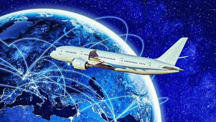
To the casual observer glancing at a flight tracking map, the path of a long-haul jet often looks like a bizarre, unnecessary curve that deviates significantly from a direct line. However, the straight line is frequently an illusion born of flat-map distortion or a secondary priority to atmospheric physics. Pilots and flight dispatchers intentionally avoid the shortest geographical route for a variety of reasons that prioritize safety, fuel efficiency, and passenger comfort, ensuring that every departure is a calculated compromise between geometry and reality. This guide explores why the shortest path almost never wins the battle of the flight plan, revealing the hidden highways of the sky that dictate how we move across the globe.
Behind every detour lies a mountain of technical data and theory, ranging from great-circle geometry to pressure-pattern navigation. By the end of this article, you will understand how pilots navigate the Intertropical Convergence Zone, surf invisible wind currents, and respect the strict safety circles of ETOPS regulations. There are several technical factors to consider, but the answer is much less complicated than it may seem.
Why Such A Strange Line?

On a flat Mercator projection map, the kind most of us have used since elementary school, the shortest distance between two points looks like a straight line. However, because the Earth is an oblate spheroid, the shortest distance between two points on its surface is actually a segment of a great circle, also known as an orthodromic path. When this straight path on a sphere is projected onto a flat map, it appears as a wide, sweeping curve that often arcs toward the poles.
This geometric reality is a core component of high-altitude navigation. If a pilot were to follow a constant compass heading, known as a rhumb line or loxodromic path, they would actually be flying a longer, less efficient route that fails to account for the Earth’s curvature. By following a Great Circle route, airlines can save thousands of pounds of fuel and significant amounts of time on transcontinental flights. This is why a flight from Los Angeles to London appears to fly up over Canada and Greenland; not a detour, but the most direct path possible on a round planet.
However, even the Great Circle route is merely the starting point for a flight plan. Geometry provides the shortest physical distance, but it does not account for the fluid dynamics of the atmosphere. Modern flight planning software takes the orthodromic path and then bends it further to account for wind and the volatile nature of global weather patterns. This ensures that the jet is not just traveling the shortest distance, but the most efficient path through a constantly shifting environment.
Riding The Wind

Beyond the pure geometry of the sphere, the single most common reason pilots deviate from the shortest path is wind. The jet stream, a high-altitude, fast-moving river of air, can reach speeds exceeding 200 miles per hour (321.8 km/h). Instead of fighting against these currents or ignoring them, flight planners use pressure pattern navigation to fly along with the wind. When flying eastbound, aircraft often take a significantly longer geographical path just to stay within the core of a tailwind, which can shave one hour or more off a flight from New York to London, for example.
The reverse is true for westbound flights. To avoid brutal headwinds that would skyrocket fuel consumption and extend flight times, pilots will intentionally fly hundreds of miles out of their way to find calmer air. Research from the University of Reading has highlighted that better utilization of these favorable winds could reduce fuel consumption by an average of 2.5% on eastbound transatlantic flights, with some flights saving up to 16% of their total fuel load. In aviation, the fastest and shortest are rarely the same thing.
The decision to deviate for wind is a complex calculation that involves the aircraft’s minimum time track. If the extra distance traveled is offset by the increased ground speed provided by the wind, the deviation is considered successful. For long-haul carriers, these daily adjustments are vital for maintaining schedules and reducing the fleet’s carbon footprint. By treating the atmosphere as a dynamic partner rather than an obstacle, pilots turn the longest geographical path into the most sustainable one.
What Are Airline Great Circle Routes?
It is the standard measurement used to determine the point-to-point distance across the surface of a sphere.
An Area To Avoid

When crossing the equator, pilots encounter one of the most formidable weather phenomena on the planet: the Intertropical Convergence Zone (ITCZ). Known to sailors as the doldrums, this region is where the trade winds of the Northern and Southern Hemispheres meet, creating a permanent band of intense convective activity. In this zone, massive cumulonimbus clouds can reach altitudes of 60,000 feet (18,288 m) or more, far above the cruising ceiling of a standard commercial jet.
These storms contain extreme turbulence, lightning, and the risk of severe icing, so pilots cannot simply fly over them. Instead, they must use weather radar to weave through the gaps or, in severe cases, detour hundreds of miles around a particularly active cluster of storms. This is a prime example of safety taking priority over distance. A direct route through a line of tropical thunderstorms would be dangerously turbulent and could cause structural damage to the aircraft, making a 200-mile (321.8 km) detour a necessary and professional decision.
|
Weather Feature |
Standard Mid-Latitude Storm |
ITCZ Convective Cell |
Pilot Action Required |
|
Vertical Reach |
35,000 feet (10,668 meters) |
60,000 feet+ (18,288 meters) |
Lateral deviation |
|
Turbulence Risk |
Moderate |
Severe/Extreme |
Avoid by 20 miles (32.1 km) |
|
Detection |
Clear on Weather Radar |
Often hidden by rain |
Wide detour necessary |
|
Distance Impact |
5–15 miles (8–24.1 kilometers) |
100+ miles (160.9 kilometers) |
Significant re-routing |
Keeping safe in areas such as this demands an understanding of meteorology, particularly the identification of supercells and the understanding of updrafts that can carry moisture to extreme heights. Pilots must also balance the fuel required for these detours with the legal reserves required for their destination. In the ITCZ, the shortest route is often the most dangerous, and the long way around is the hallmark of a disciplined and safety-conscious flight crew.
Rules Of The Sky

The sky isn’t a free-for-all space and is a patchwork of sovereign airspaces, each governed by its own regulations and security situations. Pilots and flight planners must constantly monitor NOTAMs that signal airspace closure due to conflicts, military exercises, or diplomatic disputes. If a direct great-circle route passes over a country experiencing civil unrest or active warfare, the airline will proactively reroute the aircraft to ensure the safety of passengers and crew.
These geopolitical detours can add thousands of miles to a journey. For example, during certain global conflicts, flights between Europe and East Asia have been forced to fly south around the Himalayas or north through the Arctic to avoid restricted zones. This adds significant time and fuel cost to the flight, but it is a non-negotiable requirement by international safety standards. Airlines maintain specialized departments that stay on top of the latest safety information to ensure their jets never end up over hostile territory.
There are also noise abatement procedures and environmental restrictions that can force a flight off its most direct path during the climb and descent phases. These legal and social constraints mean that the shortest route is often legally closed to the pilot. When you see your plane taking a wide turn around a specific country or city, it is likely to remain in compliance with international law or local environmental regulations.
Behind The Door: Airline Captain Reveals What Really Happens After Takeoff
Getting the plane in the air is just the start…
Heading Into The Blue Below

Twin-engine aircraft sometimes take a more curved path over the ocean compared to four-engine jets. This is due to ETOPS (Extended Diversion Time Operations), a set of safety regulations that dictate how far a twin-engine plane can be from a suitable diversion airport at any given time. If one engine fails, the aircraft must be able to reach a runway within a certified timeframe, usually ranging from 180 to 370 minutes.
This safety net creates a series of invisible circles across the globe. To remain within these circles, pilots must often fly a route that hugs the coastline or follows a specific string of islands, even if the Great Circle route would take them further out into the open sea. While modern engine reliability has allowed for much more direct ETOPS routes, the requirement to always have a Plan B airport within reach still forces many flights away from the shortest route possible.
For the flight crew, managing an ETOPS flight requires constant monitoring of weather at potential diversion airports. If a planned emergency airport suddenly experiences a blizzard or a runway closure, the pilot may have to alter the flight path mid-journey to ensure they remain within the safety circles of a different, open airport. Dynamic rerouting is a core part of the pilot’s responsibility to protect lives on board, once again showing that fast doesn’t always mean safe.
Shortest Doesn’t Mean Fastest

Every flight represents a trade-off between distance, time, fuel cost, weather avoidance, and legal airspace, and the shortest route almost never wins all of them simultaneously. A flight that is 300 miles (482.8 km) longer geographically but has a 100-mph (160.9 km/h) tailwind will arrive earlier and use less fuel than the shorter path, making it the objectively better choice for the airline and the environment.
In all, the bizarre turns on your seatback map are the result of thousands of calculations aimed at your comfort and safety. Future outlooks for the industry involve even more advanced AI-driven routing that can react in real-time to micro-shifts in the jet stream, potentially saving millions of gallons of fuel annually. As sustainable aviation becomes even more of a buzzword, the straight line will likely become even rarer as we find new ways to harness the natural energy of the atmosphere to move through it more efficiently.
Ultimately, the goal of any pilot is to deliver passengers to their destination with the highest level of safety and the lowest physical and environmental costs. Whether it is arcing toward the North Pole to respect the Earth’s geometry, diving south to catch a jet stream, or weaving through the massive thunderstorms of the ITCZ, every mile added to the journey is an investment in a successful arrival. The shortest route is a mathematical curiosity, but the best route is a masterpiece of engineering, physics, and professional judgment.