dailynewsnblog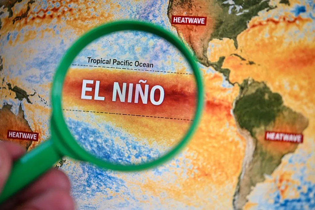
The word “super” often indicates something compelling or extraordinary. But put it in front of El Niño and “super” takes on a much more concerning meaning.
You may have read headlines about El Niño and how the developing one is expected to peak this winter and be particularly nasty. You may have read how this one is going to be the strongest in history, but what does that really mean? Who is going to be affected? How can we all prepare for the worst?
Before you start thinking we’re going to experience an apocalyptic storm of the century, the term “super El Niño” is just an informal term for a stronger-than-usual El Niño. At its most basic, it means that surface water in the Pacific is several degrees warmer than usual, setting off a climate domino effect that brings cooler, wetter weather to the US South and drier, milder winter weather to the North. Let’s break that down more below.
What is El Niño?
At its simplest, El Niño, which means “Little Boy” in Spanish, is a recurring climate pattern that forms in the tropical Pacific Ocean, where unusually warm water is pushed eastward toward the west coast of the Americas.
Typically, trade winds blow westward along the equator, pushing large amounts of warm surface water from the oceans around South America toward Asia and the Western Pacific, while cold water upwells from deeper layers to replace the warm water that has moved. El Niño is a break in this pattern. Specifically, the trade winds weaken, pushing warm water back eastward and effectively reducing the upwelling of colder water.
This simple break has global climate impacts well beyond South America, leading to atypical weather events, ecosystem disruptions and natural disasters like wildfires – mainly in North America. Because the Pacific Ocean is unusually warm, the warming alters atmospheric conditions. It intensifies and shifts the jet stream – bands of strong wind high in Earth’s atmosphere that blow east to west – more southward, which brings heavy rainfall, strong storms and frequent flooding to the southern parts of North America, while simultaneously bringing unusually warm and dry conditions to the Pacific Northwest and southern parts of Canada.
Notably, El Niño is part of the cycle called El Niño-Southern Oscillation, or ENSO, which also includes La Niña. To keep it short: La Niña occurs when those westward trade winds reintensify, becoming even stronger than typical, pushing warm water into the Western Pacific, shifting the jet stream northward, and making the southern US experience drought-like conditions while the Pacific Northwest experiences intense storms and rainfall.
In short, El Niño is the warm phase of the ENSO cycle, while La Niña is the cold phase.
Is El Niño annual?
No, El Niño (and La Niña) occurs irregularly every two to seven years, and can last anywhere between nine and 12 months. The range is so vast because triggers like wind and weather changes occur randomly, making the exact timing of an El Niño event hard to predict.

What makes this El Niño ‘super’?
You have likely heard climatologists and meteorologists say that the forthcoming El Niño will be particularly strong, even extreme. Just this week, it officially leveled up to “super” status, as researchers have speculated for months.
Does that mean we should expect extreme weather? Not exactly.
“Super El Niño” is a reference to an unusually strong event thanks to the much warmer-than-average surface waters in the Pacific. The National Oceanic and Atmospheric Administration determines the “strength” of an event by measuring the above-average water temperature using a metric called Niño 3.4 Relative Oceanic Niño Index.
The Pacific surface waters just reached the temperatures of 2 degrees Celsius or 3.6 degrees Fahrenheit above average, surpassing the threshold for “very strong,” the highest official distinction, into “super” territory.
This El Niño is slated to only get stronger, with NOAA’s latest forecast from Sept. 10 predicting that the upcoming event is 75% likely to be the strongest ever recorded since recordkeeping began in 1950 and will likely peak in late fall or early winter.
How does it impact hurricane season?
El Niño is expected to lessen hurricane and tropical storm activity in the Atlantic and Gulf of Mexico this fall and winter. Hurricane season officially kicks off June 1 and runs through Nov. 30 in the Atlantic Basin. There has yet to be a recorded hurricane, and only five weak tropical storms have occurred in the region as of mid-September 2026, which is atypical.
The lack of hurricane activity in 2026 has broken the satellite-era record for the longest period without an Atlantic hurricane, according to the Weather Prediction Center.
On the other hand, storm activity has increased in the Pacific, with Hawaii already seeing four major storms this season (Hurricane Fausto in July, Hurricane Lala and Tropical Storm Moke in August, and Hurricane Lowell in early September).
What about winter?
While Atlantic hurricanes may be less frequent or strong, El Niño will upend winter weather across the US.
Experts underscore that not every El Niño winter is exactly the same, but typically, the northern US is likely to experience a milder, drier winter, while southern states are likely to experience cooler, wetter weather than usual.
“Every El Niño is not the same; each one is unique with its own imprint on our weather,” Ken Graham, director of NOAA’s National Weather Service, said in a statement.
Experts are not sounding alarms about El Niño preparation across the US, emphasizing that just because this event is unusually strong doesn’t mean there will be unusually intense weather.
Northeasterners can expect less snow on average this winter, and states in the northern tier of the country (including the Pacific Northwest to the Midwest) can expect warmer-than-average temperatures from December through February. While anything can happen, northern states can expect a mild winter that may not require extensive preparation.
The southern tier and many East Coast states can expect more rain and snow this winter, which may require special preparation, as these states have less infrastructure to handle snow and ice. Certain regions – especially Southern California and parts of the Southeast around the Gulf Coast – should prepare for above-average precipitation between December and February. This could mean more flooding.
How can I prepare and stay safe?
Though extreme weather conditions may be rare, it’s still best to be prepared. Before this winter season, make a household plan for any potential evacuations, including planning driving routes and arrangements for kids or pets. It’s also important to have a pre-assembled emergency kit with nonperishable food, medications, first-aid supplies, batteries, cash and more. You can read our full guide on preparing an emergency go-bag here.
“If your home receives more than the usual amount of snow (or your first snowfall ever), see if you need to add new chores like raking a roof to prevent ice dams or installing a leak detector under pipes to spot burst or leaking pipes early,” said CNET Senior Editor Tyler Lacoma.
“If you have outdoor home devices, make sure they’re ready to weather cold conditions and storms,” Lacoma said. “You can check IP ratings on your tech to see if it can handle below-freezing temperatures, or take sensitive electronics like security cameras out of the direct wind. On the plus side, there’s also new technology that can help with unexpected blackouts.”
One of the key aspects to monitor will be power outages caused by storms, especially in areas expected to receive above-average amounts of rain, ice or snow. In addition to preparing an emergency kit, consider unplugging electronic devices, like TVs and phones connected to chargers, during storms to prevent damage from power surges. As someone who has experienced my fair share of hurricanes and extreme thunderstorms, I’ve personally invested in a surge protector. I use the Belkin 12-outlet surge protector around my home, but CNET has tested several of the top surge protectors on the market.
In the event of a power outage, consider a backup power source, such as power stations, power banks or backup generators. CNET has conducted extensive testing of portable power stations, evaluating over 140 products to find the most reliable and longest-lasting.
It’s also best to monitor official alerts. Stay updated on information from the National Weather Service and local authorities for alerts on storm warnings, tornado watches, flood information and evacuation instructions. Follow these agency instructions promptly. If local authorities recommend or even mandate an evacuation, leave immediately using designated routes, and stay inside during heavy rain and snowfall.
Remember that El Niño weather is unpredictable. Treat it as a potential mix of risks rather than a precise forecast.

See full bio