Listen to this article
Estimated 2 minutes
The audio version of this article is generated by AI-based technology. Mispronunciations can occur. We are working with our partners to continually review and improve the results.
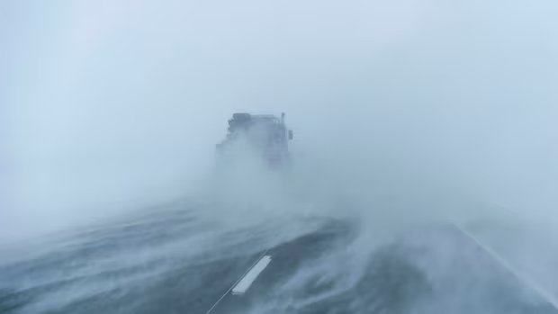
A snowfall warning that was in place for most of northern Manitoba has intensified into a blizzard warning.
The warning says gusty winds of 70-80 km/h and blowing snow will create long-lasting conditions of near-zero visibility. By the time the system moves out Saturday, total snowfall amounts are expected to be around 30-50 centimetres.
The warning area stretches from Thicket Portage north to the Nunavut border, including the city of Thompson, where La Voie du Nord school is closed for Thursday. Churchill and the area around Hudson Bay are not under a warning as of 9 a.m.
Hazardous conditions are also expected in parts of west-central Manitoba, which remains under a winter storm warning. About five to 10 millimetres of freezing rain is expected to fall, followed by 15 cm of snow.
That system will hit Thursday and last through to Saturday, Environment Canada forecast. The impacted area includes Flin Flon, Cranberry Portage, Sherridon and Snow Lake.
Yet another warning, for freezing rain, stretches across central Manitoba from The Pas through Gods Lake to the Ontario border.
Freezing rain, heavy at times, is expected to fall through the day into Thursday evening. Amounts could exceed five millimetres, the warning says.

Up to 50 centimetres of snow is expected in parts of northern Manitoba by the weekend. There is a risk of scattered showers or isolated thunderstorms across the south.