Listen to this article
Estimated 4 minutes
The audio version of this article is generated by AI-based technology. Mispronunciations can occur. We are working with our partners to continually review and improve the results.
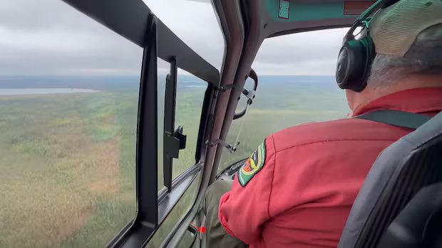
Kasabonika Lake First Nation in northwestern Ontario has paused an evacuation of its most vulnerable members, as a cluster of five wildfires surrounding the community have stabilized for the time being.
The remote Oji-Cree First Nation declared a state of emergency over the weekend due to escalating wildfire activity. The first wave of evacuees were flown out Sunday evening, landing in Thunder Bay before flying further south to Toronto.
Kasabonika Lake’s Chief Matthias Anderson says as of Thursday afternoon, 548 evacuees remain in Toronto and 37 more are on the way from Thunder Bay.
The evacuees, which make up nearly half the First Nation’s population, largely consist of elders, children, prenatal mothers and people with medical conditions. This is the community’s first evacuation in 20 years.
“It changes by the hour, this fire situation, so it’s been stressful for most of us,” Anderson said.
“Right now it has calmed down. I’m hoping things will be better.”

There are more than six dozen active wildfires in Ontario’s northwest region as of Thursday afternoon. Of these, 21 are not under control, seven are being held, four are under control and the rest are being observed.
Recent rainfall has offered some reprieve for fire crews in the far north, though thunderstorms have created another challenge — producing thousands of lightning strikes across the region, said Chris Marchand, fire information officer with Aviation, Forest Fire and Emergency Services in the northwest.
“Precipitation has been highly localized, with some areas receiving significant rainfall while others remain quite dry,” Marchand said.
“We’re seeing a lot of detection aircraft focusing on areas that have experienced lightning activity, searching for those new fires that may be holding over in the ground.”
Forest fire hazard levels range from low to high across the northwest, with a pocket of extreme hazard in the Thunder Bay-Ignace district.
“Wildland fire hazard levels change regularly based on the weather and field conditions, so we just ask that before conducting any sort of outdoor burning, that residents check local conditions,” said Marchand.
Navigating changing conditions
Northwestern Ontario’s largest fire, known as Sioux Lookout 1, is being observed at more than 17,200 hectares in size. It started May 30.
As for the cluster of fires near Kasabonika Lake, the biggest one in the area — Nipigon 16 — measures more than 1,470 hectares.
South of Kasabonika Lake, a fire known as Sioux Lookout 21 is located 9 kilometres south of Wunnumin Lake First Nation’s airport.

However, Chief Archie Wabasse told CBC News Thursday afternoon that the blaze is shifting away from the community.
“The response we got from the MNR (Ministry of Natural Resources) was really good,” Wabasse said.
Back in Kasabonika Lake, Anderson said he’s learned a lot over the past few days, and is grateful for support from the MNR and Emergency Management Ontario.
Community leaders are continuing to monitor the situation to determine when evacuees may be able to come home, he said.
“I don’t think most of the personnel here were here for the last evacuation — we relied on the older generation to help us,” Anderson said.
As for Marchand, he urges people to report any wildland fires they see to 310-FIRE, and to check the Ontario Forest Fires website and interactive forest fire map for the latest information.