dailynewsnblog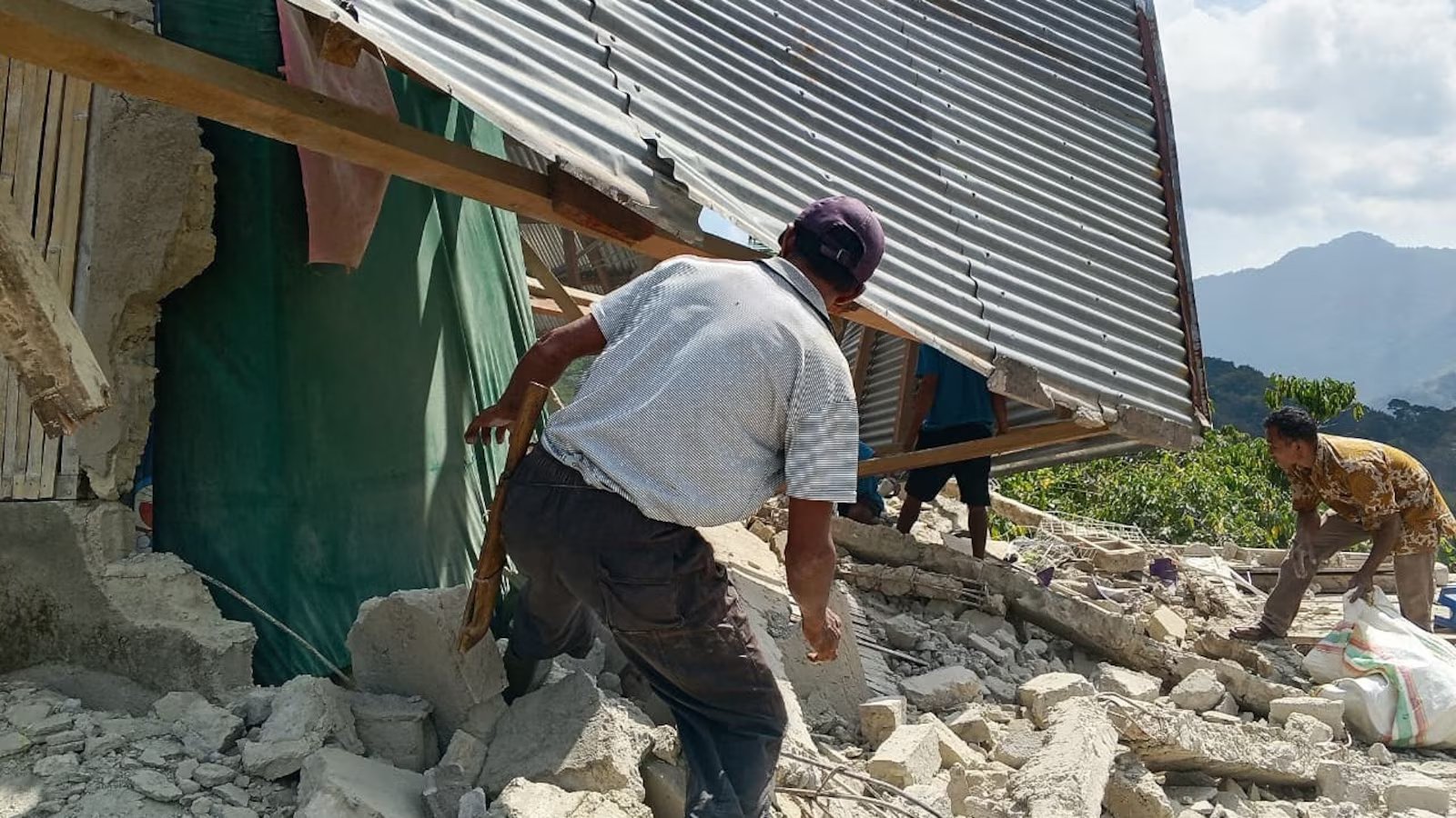
A magnitude 6.9 earthquake has hit Indonesia just hours after an even more powerful magnitude 7.7 quake struck off the coast of eastern Indonesia, according to the U.S. Geological Survey, killing at least 38 people, according to the National Disaster Management Agency (BNPB), knocking down some buildings and leading hundreds to evacuate amid fears of a tsunami, officials said.
At least six others were injured and two more are missing, according to the Associated Press. Indonesia’s national disaster management agency said in a statement on social media initially that two people had been killed.

People examine the damage to a house following an earthquake in East Manggarai, East Nusa Tenggara province, Indonesia, Saturday, Aug. 15, 2026.
Kurniawan/AP Photo
Emergency crews, including members of the Indonesian National Armed Forces, were conducting evacuations and assessing damage.
The agency said the earthquake, which struck shortly before 5 a.m. local time, was strongly felt across the province of East Nusa Tenggara.
The quake initially triggered fears of a tsunami, and a warning from Indonesia’s Meteorology, Climatology and Geophysics Agency, issuing alerts to stay away from beaches and calls for people to evacuate. However, those warnings later expired, according to the Associated Press.
Before then, about 2,000 residents in the Nagekeo Regency on the Flores island “carried out self-evacuation as a precautionary measure after the earthquake and due to the early warning of a tsunami,” the disaster management agency said.

This handout picture taken and released on August 15, 2026 by Indonesia’s National Search and Rescue Agency (BASARNAS) shows rescuers working amid the rubble of a damaged building after an earthquake in Maumere, East Nusa Tenggara. A powerful 7.7-magnitude earthquake struck off Flores island in eastern Indonesia early on August 15, killing at least two and sending thousands running in panic after authorities issued a tsunami warning.
Handout / INDONESIA’S NATIONAL SEARCH AND RESCUE AGENCY (BASARNAS) / AFP via Getty Images) /
The earthquake’s epicenter was located about 60 kilometers north-northwest of Ende in Indonesia’s Flores region at a depth of about 10 kilometers, according to USGS.
There were a number of strong aftershocks reported nearby, including a 6.1 quake and a 5.9 quake also north of Ende, according to the USGS.

A damaged building is seen following a 7.0-magnitude earthquake in Ruteng, Manggarai, East Nusa Tenggara, on August 15, 2026. A strong 7.7-magnitude earthquake struck off Flores island in eastern Indonesia early on August 15, the US Geological Survey and Indonesian authorities said, triggering a tsunami warning and prompting hundreds to evacuate.
Selo/AFP via Getty Images
Photos from the area showed damage to buildings.