dailynewsnblog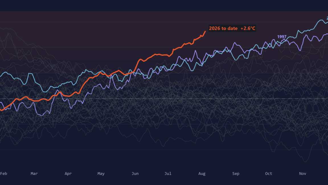
The city of Houston, where I live, has been ground zero for the 2026 Atlantic hurricane season. So far this year there have been two named storms, Arthur and Bertha, that have formed. And the centers of both have passed near or directly over Houston.
Two “strikes” in a year might seem notable, but like the middling hurricane season to date, Arthur and Bertha were both middle-of-the road tropical storms in terms of intensity.
As a resident of a coastal region prone to hurricanes, one never wants to tempt fate. And in truth, since it is only early August, the bulk of seasonal activity definitely lies ahead of us. But all indications are we can look forward to a quiet season.
Why this season should be below normal
Why? First, there’s the start. By the metric of “accumulated cyclone energy,” a good measurement of overall intensity and duration of tropical systems, this year’s value to date is less than 30 percent of where things normally are. Historically, the Atlantic basin has usually seen three or four named storms by now, with one of those becoming a hurricane.
Additionally, this is almost the time of year when the Atlantic season starts to ramp up. However, things look very quiet for at least the next week or 10 days, and there is no evidence of a bunch of menacing tropical waves starting to emerge off the coast of Africa.
The leading seasonal hurricane forecaster, Phil Klotzbach at Colorado State University, has steadily been revising his outlook downward. In April, he and his team predicted 13 named storms and six hurricanes this season. In his latest, and final, outlook issued Wednesday, he is predicting nine named storms and four hurricanes. He expects the season’s accumulated cyclone energy to only be about 40 percent of normal levels.
This would be a well-below-normal season, and certainly a welcome one for coastal residents in the United States from South Texas to Florida to Maine.
El Niño is very rapidly strengthening
The primary reason is the strengthening El Niño in the equatorial Pacific Ocean, which has global weather impacts. Among them is higher wind shear across the Atlantic basin, where a majority of hurricanes form and strengthen.