dailynewsnblog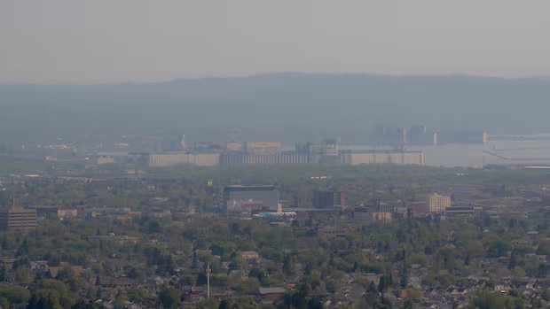

Listen to this article
Estimated 5 minutes
The audio version of this article is generated by AI-based technology. Mispronunciations can occur. We are working with our partners to continually review and improve the results.
The province has issued another evacuation order for an area in northwestern Ontario as wildfires continue to burn across the region.
The evacuation order was issued for an area near the Fort Frances 14 fire, which was just over 55,000 hectares in size and not under control as of Thursday evening.
People in the area of Baril, Bedivere and Windigoostigwan lakes and Lac des Mille Lacs have been told to leave immediately, unless they have a travel permit issued by the Ministry of Natural Resources (MNRF).

Overall, there were 129 active fires burning in the region as of Thursday evening, the provincial Aviation, Forest Fire and Emergency Services (AFFES) agency said.
Evacuations
The Fort Frances 14 evacuation order is one of many that have been issued by the province in recent days.
Other areas and communities that have been evacuated include:
- Armstrong.
- Whitesand First Nation.
- Namaygoosisagagun First Nation (also known as Collins First Nation).
- Lac des Mille Lacs First Nation.
- Gakijiwanong Anishinaabe Nation (also known as Lac La Croix First Nation).
- Kiashke Zaaging Anishinaabek (also known as Gull Bay First Nation).
- Cat Lake.
- Ojibway Nation of Saugeen.
- Eabameetoong.
- Mishkeegogamang.
- McDowell Lake.
- Hutchison.
- Ramsay Wright.
- Trottier.
- Weaver.
- All areas accessed by Boot Lake Road, Camp 111 Road, Crooked Pine Lake Road, Duck Lake Road, Marion Lake Road , Premier Lake Road, Sapawe-Upsala Road, Stanton Bay Road, and White Lily Road.
- Como Lake.
- Crystal Lake.
- Eva Lake.
- Magnetic Lake.
- Marion Lake.
- Mercutio Lake.
- Niobe Lake.
- Nydia Lake.
- Sapawe Lake.
- Whiskeyjack Lake.
- Windigoostigwan Lake.
Several other communities and areas have also been told about potential evacuations:
- Quetico.
- Crystal Lake.
- Atikokan.
- Niobi Lake.
- Pickle Lake.
- Ignace.
- Upsala.
Highway closures
Highway 527 in both directions between Gull Bay and 1st Ave and Armstrong, and Highway 599 between Highway 516 and Pickle Lake, remain closed due to wildfire activity.
Air quality and weather
Orange air quality alerts are in effect for:
- Armstrong.
- Wabakimi Park.
- Atikokan.
- Shebandowan.
- Quetico Park.
- Beardmore.
- Thunder Bay.
- Cloud Bay.
- Dorion.
- Dryden.
- Vermilion Bay.
- Ear Falls.
- Fort Frances.
- Emo.
- Rainy River.
- Gull Bay.
- Ignace.
- Kakabeka Falls.
- Whitefish Lake.
- Arrow Lake.
- Kenora.
- Grassy Narrows.
- Marathon.
- Schreiber.
- Nipigon.
- Rossport.
- Pickle Lake.
- Cat Lake.
- Red Lake.
- Woodland Caribou Park.
- Sandy Lake.
- Deer Lake.
- Sioux Lookout.
- Sioux Narrows.
- White River.
Yellow air quality warnings, meanwhile, are in effect for Manitouwadge, Hornepayne, Geraldton, and Longlac.
However, Environment Canada said some improvement to air quality in the region may be coming on Friday, thanks to a possible shift in wind direction.
In addition, Friday’s forecast is calling for showers, which meteorologist Peter Kimbell said “tends to scour the atmosphere of the smoke particles.”
However, Kimbell added that the smoke will likely return if the wind shifts back to the northwest.
Fire hazard
The fire hazard remains high through much of northwestern Ontario, with moderate and low hazard in western parts of the region.
A restricted fire zone has been implemented for much of the region, as well, which prohibits any open-air burning, including campfires.
Thunder Bay residents come together to support wildfire evacuees with toy drive, donation drop-offs
Many municipalities and communities in the region have also implemented their own fire bans, including Thunder Bay, Oliver Paipoonge, Shuniah, Neebing, Lappe, Kenora, Dryden, Red Lake, and Sioux Lookout.
Cancellations, suspensions and closures
The air quality issues have led to a number of services, programs and events being suspended, cancelled, or shut down.
All outdoor pools, beaches and splash pads run by the City of Thunder Bay have been closed, as have Chapples and Strathcona golf courses, the Centennial Botanical Conservatory, all washroom facilities in public parks, and outdoor marina services.
Parks and playfields are open, but not staffed, and programs and activities are being moved indoors where possible.
Residential garbage collection is continuing — the city said there may be delays — but business and multi-residential garbage collection has been suspended.
Essential city services, including transit and emergency services, are running.
The Thunder Bay Border Cats have postponed Friday’s doubleheader against the Wausau Woodchucks due to air quality and forecasted rain.
‘Good news and bad news:’ What Thunder Bay, Ont., can expect related to air quality over next 36 hours
Fort William Historical Park has also cancelled Celtic Day, which was scheduled to take place Sunday.
The Thunder Bay District Health Unit announced this week it was altering its services levels due to air quality, with routine client-facing services suspended on Friday.
The health unit’s office on Balmoral Street will also be closed to the public on Friday, but the health unit said it will remain open for staff and essential services.
Thunder Bay’s annual Festival of India has also been postponed. It will now take place on Aug. 15.