Late summer rain is causing havoc across Australia, with South Australia on flood watch, Victoria cleaning up after a downpour, and Sydney issuing a shark warning after heavy falls.
Almost all of South Australia, much of western Victoria and parts of western NSW were on flood watch as a slow-moving pressure system from central Australia moved east. Queensland had also seen severe rainfall.
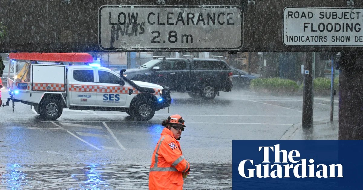
Parts of Victoria received more than double their average February rainfall overnight on Friday.
Meanwhile, sustained rain in Sydney over the last few days led to official warnings that murky water conditions can increase bull shark activity.
The South Australian premier, Peter Malinauskas, warned residents to prepare as heavy falls of 50-100mm were forecast for much of the state, with flash flooding possible in Adelaide when the system arrived in the capital on Saturday.
“It is not unusual in South Australia or metropolitan Adelaide to see a 10-millimetre rain event,” he said.
“But when we start to see rain events north of 50, 60, 80mm, that starts to represent the sort of conditions where we will see flash flooding.
“If we see that volume of rain in a short period of time, then we should anticipate flash-flooding events throughout the state.”
Sign up: AU Breaking News email
The Eyre Peninsula has had severe falls since Friday morning, with 71mm falling in Ceduna, 68mm at Wudinna and 98mm at Minnipa, the Bureau of Meteorology said.
Moomba in the state’s north-east had close to 100mm this week and has had 189mm in February – exceeding its annual average rainfall of 176mm.
The senior meteorologist Dean Narramore said the rain was badly needed for large parts of the state, which have been battling long-term rainfall shortages.
“South Australia has been so dry for so long, this would mostly be welcome,” he said.
“I think generally it’s a good news story apart from the flash flooding.”
In Victoria, 96mm was recorded at Horsham airport overnight on Friday, about five times the regional city’s average rainfall for February of 19mm. Warracknabeal received 49mm, more than double its average February rainfall, while areas around Mount Macedon and Gisborne had hail storms.
Melbourne was expecting fine weather on Saturday but showers could begin on Sunday before heavier falls on Sunday night and Monday.
In Queensland, severe falls continued in inland areas. The outback town of Birdsville, where the annual average rainfall is 162mm, had received 178mm so far in 2026 and 128mm of that fell over three days this week.
Narramore said the rainfall battering South Australia was expected to continue through the weekend before moving into western NSW and western Victoria before the system weakens mid-week.
Narramore said a monsoon trough over northern Australia would strengthen throughout the weekend “bringing widespread rain, falls and possible flooding”.
“We could see a tropical low possibly develop across northern Australia next week as well,” he said.
In the east of NSW, the Minns government was urging beach and waterway swimmers and surfers to exercise caution because recent heavy rainfall could create murky conditions that increase bull shark activity in Sydney Harbour, other estuaries and along the NSW coast.
“If your local beach is closed due to the weather, shark sightings, or poor water quality, we ask beach goers, swimmers and surfers, to not enter the water for their own safety,” the regional NSW minister, Tara Moriarty, said.
“If you’re on the coastline, by the harbour or on waterways, it’s important to understand how the environment can influence shark behaviour and to then take the necessary steps to reduce your risk of a shark interaction.”
Four attacks occurred in the state at the start of the year, including one inside Sydney Harbour that took the life of a 12-year-old boy.
The climate crisis is making Australia more vulnerable to extreme weather and natural disasters, including intense rainfall. In 2025, the third-hottest year on record, global surface air temperatures averaged 1.48C above preindustrial levels. For each 1C of heating, the atmosphere can hold 7% more moisture.