Temperatures have begun to soar as the east coast of New South Wales experiences its first heatwave of the summer, while in Tasmania fire authorities continue to battle several bushfires.
Heatwave warnings were also in place for parts of the Northern Territory, Queensland and Western Australia on Friday, including an extreme heatwave warning in WA’s Pilbara region.
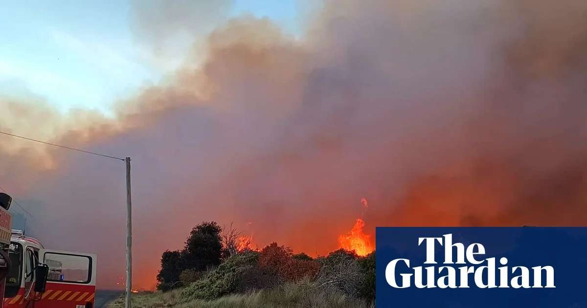
The Tasmania Fire Service said firefighting efforts were focused on Dolphin Sands in the state’s east with residents who had left the area overnight advised it was not yet safe to return.
Sign up: AU Breaking News email
Simon Pilkington, the southern regional chief for the fire service, said on Friday morning the service was “aware of property losses in Dolphin Sands, and will be completing rapid impact assessments this morning to confirm the extent of this when safe to do so”.
The TFS said residents of Glenlusk near Hobart, where another fire has been burning, could return with caution, while residents of Abels Bay, Colebrook, Levendale and Rhyndaston were advised to monitor conditions in those areas.
In NSW, temperatures had reached 31C in the Sydney CBD and Richmond by 10am and 33C at Olympic Park.
“It’s got very hot, very early. We’ve had those winds coming from the west really heating things up quite quickly,” Bureau of Meteorology forecaster Jonathan How said.
“Today we’re still going for 35C in the city and eastern suburbs. Anywhere west of Parramatta will probably get to 40C.”
A severe heatwave warning is in place for the Hunter, metropolitan, Illawarra, central tablelands, southern tablelands and Snowy Mountains regions, while an extreme heatwave warning – indicating the highest level of risk – remains in place for the south coast.
Australia’s national annual average temperature is about 1.5C higher than in 1910, according to the BoM, and the climate crisis has increased the frequency and severity of extreme weather events.
Scone and Muswellbrook in the Hunter region were expecting 40C and 41C respectively on Friday, while Newcastle was forecast to reach a top of 39C.
Extreme fire danger warnings were in place for areas including Sydney and the Hunter.
In the far north-west of the state, temperatures above 40C were forecast in places including Walgett and Bourke.
How said high minimum temperatures were forecast in the greater Sydney region on Friday night, with temperatures unlikely to drop below 21C in the city and 23C in the west.
He said the peak of the heatwave was expected on Saturday, when temperatures could be above 30C by 9am.
“The other thing for tomorrow for Sydney, because it’s going to be so hot and unsettled, we’ll see some thunderstorms in the early evening,” How said.
“The concern will be dry lightning, which could start new fires.”
He said people should take sensible precautions in the heat – staying out of the sun and drinking plenty of water – and monitor any warnings from the Rural Fire Service, particularly on Saturday.
The bureau has issued a severe heatwave warning for the Gulf Country in Queensland’s north-west and severe heatwave warnings remain in place for the Tiwi, Daly and Gregory regions of the NT and the Kimberley region of WA. WA’s Pilbara region has been upgraded to an extreme heatwave warning.
How said areas inland from Broome, including Fitzroy Crossing and the inland Kimberley were expected to reach 45C on Friday and Saturday and 46C on Sunday and Monday.
In Victoria, temperatures were cooler in Melbourne on Friday but were forecast to reach the high 30s in the state’s north, including the Mallee region in the north-west where the Country Fire Authority has declared a total fire ban.
How said a cool change was expected to move through the NSW coast from Saturday evening but was unlikely to reach Sydney until early on Sunday morning, bringing some light showers through the day.
He said a cold front would push through Victoria and Tasmania on Saturday, bringing showers and thunderstorms, and some snow was expected in Tasmania on Saturday evening down to about 1,000 metres.