Google Maps is adding new AI features, including a builder agent and an MCP server — a tool that connects AI assistants to Google Maps’ technical documentation — to help developers and users create interactive projects using Maps data and code. The company said it is using Gemini models across the board to power these features.
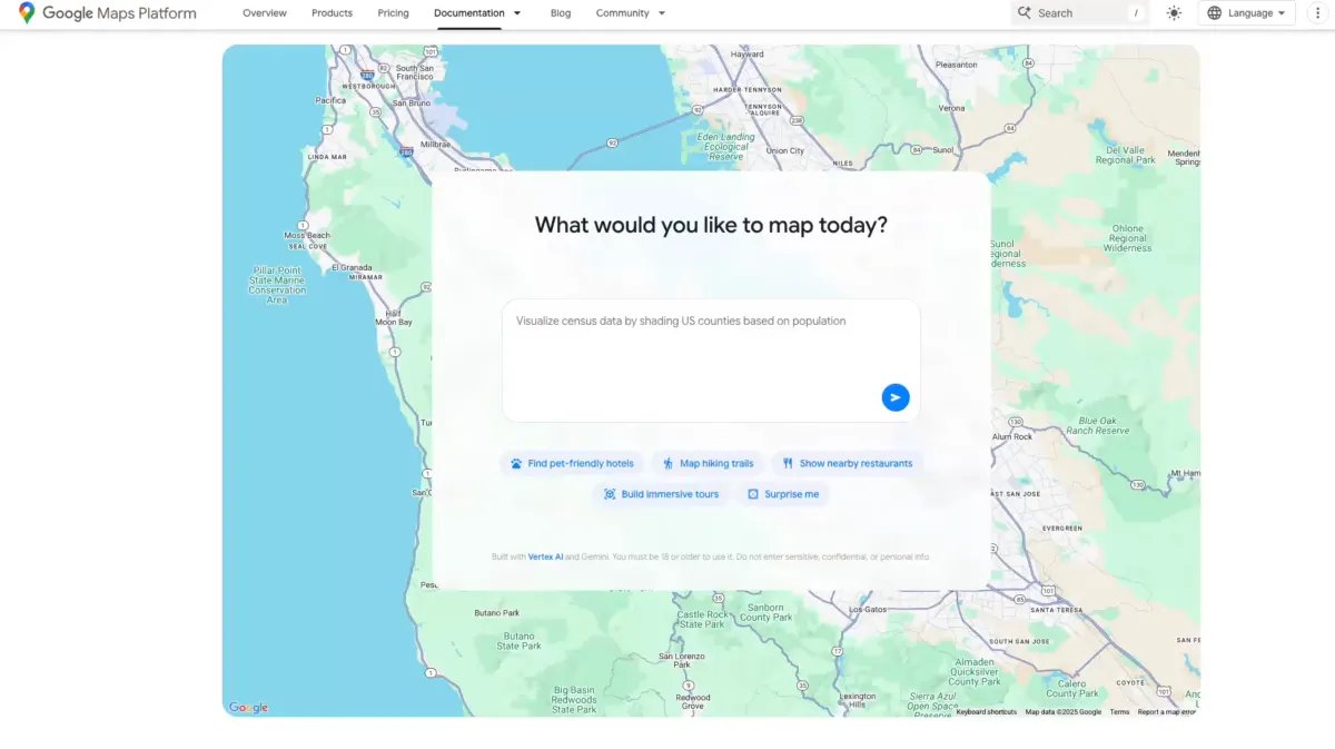
Among these new tools, the builder agent is a tool that, just like many other coding tools, lets you describe the kind of interactive map-based prototype you want to build in text and creates one for you. For instance, you can type “create a Street View tour of a city,” “create a map visualizing real-time weather in my region,” or “list pet-friendly hotels in the city.”
Once the code is generated, you can export it, test the preview project using your own API keys as needed, or modify the project in Firebase Studio.

The same tool also has a styling agent that lets users create a customized map to match a particular style format or theme. This could help brands create maps with specific color coding.
Google already provides map data grounding via the Gemini API. The company is now introducing a similar feature, called Grounding Lite, which allows developers to ground their own AI models using Model Context Protocol (MCP), a standard that lets AI assistants connect to external data sources.
With this feature, AI assistants can answer questions like, “How far is the nearest grocery store?” The company is also shipping Contextual View, a low-code Google Maps component that can provide visual understanding to users for such questions. The feature can show a list, a map view, or a 3D display as an answer.

Google is also adding a code assistant toolkit, the MCP server, which connects with Google Maps’ documentation. Developers can use this connection to get answers about how to use the Google Maps API and data. Last month, the company launched extensions for Gemini’s command line tool to let developers access Maps data.
Techcrunch event
San Francisco
|
October 13-15, 2026

The company is also trying to add more Gemini-powered features for Maps on the consumer side. Last week, it enabled users to use Gemini hands-free with Maps for navigation. For users in India, Google added incident alerts and speed limit data to the Maps app in select areas.